


BREAKING NEWS
WATCH: 5 runaway military horses cause mayhem in London
Can’t control elections or pass directions on basis of suspicion: SC tells EVM critics
I-T sleuths raiding Congress functionary’s house to defame me: D K Shivakumar
Not shying away from dealing with stray dogs issue but will not allow scope to be expanded, says SC
Karnataka govt plans to constitute SIT to probe scams in city-based cooperative banks: Shivakumar
Vijay Deverakonda, Mrunal Thakur’s ‘The Family Star’ to make OTT debut on Prime Video
Campaigning for first phase of LS polls in Karnataka ends
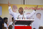
“Modi & Shah are sellers and Ambani-Adani are buyers”: Kharge’s sharp attack on BJP-led Centre
LS Polls 2024: Nitin Gadkari faints during campaign rally in Yavatmal
Ex-Jharkhand CM Hemant Soren moves SC, says HC not pronouncing verdict on his plea against arrest
Elephant ‘Malti’ transferred from Amber to Vantara elephant sanctuary
SC seeks clarification from EC on functioning of EVMs, calls poll panel official at 2 pm
Encounter under way in J&K’s Bandipora
PM waived off loans worth Rs 16 lakh crore of his billionaire friends: Rahul
Campaigning for 1st phase of LS polls in Karnataka ends today

India calls Nepal’s new map unjustified cartographic assertion
PTI, May 21, 2020, 7:51 AM IST

New Delhi: India on Wednesday, May 20 reacted angrily to Nepal showing Lipulekh, Limpiyadhura and Kalapani as Nepalese territory in a new map, saying such “artificial enlargement” of territorial claims will not be acceptable and asked the neighbouring country to refrain from such “unjustified cartographic assertion”
India’s reaction came hours after the Nepal government released a revised political and administrative map of the country laying claim over the strategically key areas along the border between the two countries.
External Affairs Ministry Spokesperson Anurag Srivastava said that the revised map of Nepal included parts of the Indian territory and asked Kathmandu to respect India’s sovereignty and territorial integrity.
“This unilateral action is not based on historical facts and evidence. It is contrary to the bilateral understanding to resolve the outstanding boundary issues through diplomatic dialogue. Such artificial enlargement of territorial claims will not be accepted by India,” he said.
He said that Nepal is well aware of India’s consistent position on the matter.
“We urge the government of Nepal to refrain from such unjustified cartographic assertion and respect India’s sovereignty and territorial integrity. We hope that the Nepalese leadership will create a positive atmosphere for diplomatic dialogue to resolve the outstanding boundary issues,” he said.
The new map was released by Nepal’s Land Reforms Minister Padma Aryal during a televised press conference in Kathmandu.
The ties between the two countries came under strain after Defence Minister Rajnath Singh inaugurated an 80-KM-long strategically crucial road connecting the Lipulekh pass with Dharchula in Uttarakhand on May 8.
Nepal reacted sharply to the inauguration of the road claiming that it passed through Nepalese territory. India rejected the claim asserting that the road lies completely within its territory.
Nepalese Foreign Minister Pradeep Kumar Gyawali last week summoned Indian Ambassador Vinay Mohan Kwatra and handed over a diplomatic note to protest against India inaugurating the key road.
In the midst of the row, Indian Army chief Gen MM Naravane said that there were reasons to believe that Nepal objected to the road at the behest of “someone else”, in an apparent reference to a possible role by China on the matter.
The Lipulekh pass is a far western point near Kalapani, a disputed border area between Nepal and India. Both India and Nepal claim Kalapani as an integral part of their territory – India as part of Uttarakhand’s Pithoragarh district and Nepal as part of the Dharchula district.
Nepalese Prime Minister K P Sharma Oli on Tuesday asserted that Lipulekh, Kalapani, and Limpiyadhura belong to Nepal and vowed to “reclaim” them from India through political and diplomatic efforts. Addressing Parliament, Oli said the territories belong to Nepal but India has made it a disputed area by keeping its Army there.
Udayavani is now on Telegram. Click here to join our channel and stay updated with the latest news.
Top News


Related Articles More

Can’t control elections or pass directions on basis of suspicion: SC tells EVM critics

Not shying away from dealing with stray dogs issue but will not allow scope to be expanded, says SC

Delhi: Man standing atop truck dies after his head hits metro station beam

Bullet train project completion date rests on award of all tenders, says Railways in RTI reply

What ‘nyay’ Cong can do, when its councillor’s daughter in K’taka doesn’t get justice: Thakur
MUST WATCH


Latest Additions

WATCH: 5 runaway military horses cause mayhem in London

FIR filed over BJP’s social media post allegedly promoting hatred and enmity: EC
Can’t control elections or pass directions on basis of suspicion: SC tells EVM critics

Amitabh Bachchan receives Lata Deenanath Mangeshkar Puraskar

Hubballi: Congress leader Randeep Surjewala visits Neha’s house, assures justice to family