


BREAKING NEWS
Firing outside Salman Khan’s home: Lookout circular issued against Anmol Bishnoi
Pune court asks police to probe bribery allegations against IT major Cognizant
Archery WC: India women’s compound team wins gold
IPL 2024: ‘Cricket is turning into baseball’, says Sam Curran after PBKS’ world record run chase
‘Taarak Mehta Ka Ooltah Chashmah’ actor Gurucharan Singh missing
Congress to discuss candidates for Amethi, Raebareli seats on Saturday
Lok Sabha 2024: Tribal hamlet of Banjarumale in Belthangady records 100% voter turnout
Lok Sabha Polls 2024: Congress suspends Surat candidate Kumbhani, whose nomination form was rejected
Yuvraj identifies Surya, Bumrah as key to India’s prospects in T20 World Cup
6 people killed as wedding pandal catches fire in Bihar’s Darbhanga
Frustration driving CM Siddaramaiah to speak against PM: Union Minister Shobha Karandlaje
LS polls 2024: Nearly 13% voter turnout in first 2 hours of polling in Udupi-Chikmagalur Constituency
Don’t be swayed by diversionary tactics, come out and vote to protect democracy: Kharge to voters
Mangaluru: Minor scuffle outside polling station at Capitanio
My family faces threat from strangers who filmed inside my house: Neha Hiremath’s father

Google Earth adds time lapse video to depict climate change
Team Udayavani, Apr 15, 2021, 7:28 PM IST

San Ramon: The Google Earth app is adding a new video feature that draws upon nearly four decades of satellite imagery to vividly illustrate how climate change has affected glaciers, beaches, forests and other places around the world.
The tool unveiled Thursday is rolling out in what is being billed as the biggest update to Google Earth in five years. Google says it undertook the complex project in partnership with several government agencies, including NASA in the US and its European counterpart, in hopes that it will help a mass audience grasp the sometimes abstract concept of climate change in more tangible terms through its free Earth app.
Cornell University climate scientist Natalie Mahowald believes that mission may be accomplished.
“This is amazing,” she told The Associated Press after watching a preview of the new feature. “Trying to get people to understand the scope of the climate change and the land use problem is so difficult because of the long time and spatial scales. I would not be surprised if this one bit of software changes many people”s minds about the scale of the impact of humans on the environment.”
This isn”t the first time time-lapse satellite imagery has been used to demonstrate show how parts of the world are changing before our eyes due to a changing climate. Most scientists agree that climate change is being driven by pollution primarily produced by humans.
But earlier images have mostly focused on melting glaciers and haven”t been widely available on an already popular app like Google Earth, which can be downloaded on most of the more than 3 billion smartphones now in use around the world
Google is promising that people will be able to see a time lapse presentation of just about anywhere they want to search. The feature also includes a storytelling mode highlighting 800 different places on the planet in both 2D and 3D formats. Those videos also will be available on Google”s YouTube video site, a service more widely used than the Earth app.
The feature was created from 24 million satellite images taken every year from 1984 to 2020 and provided by NASA, the US Geological Survey and the European Union, according to Google. The time lapse technology was created with the help of Carnegie Mellon University.
Google plans to update the time lapse imagery at least once a year.
Udayavani is now on Telegram. Click here to join our channel and stay updated with the latest news.
Top News


Related Articles More

China says talks on Tibet only with Dalai Lama’s representatives; rules out dialogue on autonomy

Indian-origin man shot, killed by San Antonio police amid attempts to apprehend him

2 Indian restaurants in Colorado duped investors of USD 380K: Officials
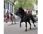
WATCH: 5 runaway military horses cause mayhem in London
Don’t blame Dubai’s freak rain on cloud seeding
MUST WATCH


Latest Additions

Firing outside Salman Khan’s home: Lookout circular issued against Anmol Bishnoi

Pune court asks police to probe bribery allegations against IT major Cognizant

2 CRPF personnel martyred in militant attack in Manipur

Voter on horseback delights voters in Udupi Chikmagalur constituency

LDF slams BJP candidate Rajeev Chandrasekhar for not casting vote