


BREAKING NEWS
‘Taarak Mehta Ka Ooltah Chashmah’ actor Gurucharan Singh missing
Congress to discuss candidates for Amethi, Raebareli seats on Saturday
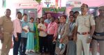
Lok Sabha 2024: Tribal hamlet of Banjarumale in Belthangady records 100% voter turnout
Lok Sabha Polls 2024: Congress suspends Surat candidate Kumbhani, whose nomination form was rejected
Yuvraj identifies Surya, Bumrah as key to India’s prospects in T20 World Cup
6 people killed as wedding pandal catches fire in Bihar’s Darbhanga
Frustration driving CM Siddaramaiah to speak against PM: Union Minister Shobha Karandlaje
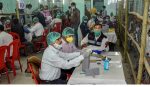
LS polls 2024: Nearly 13% voter turnout in first 2 hours of polling in Udupi-Chikmagalur Constituency
Don’t be swayed by diversionary tactics, come out and vote to protect democracy: Kharge to voters
Mangaluru: Minor scuffle outside polling station at Capitanio
My family faces threat from strangers who filmed inside my house: Neha Hiremath’s father
Rahul Gandhi to address two public meetings in Karnataka today
LS Elections 2024: Brisk voting in Udupi & Dakshina Kannada; EVM snag delays polling in some booths
IPL 2024: I’ll sleep better, says Faf du Plessis
IT sleuths threatening raided leaders to claim money belongs to me, Cong: DK Shivakumar

SIT to use satellite images to investigate illegal mining
Team Udayavani, Jan 31, 2018, 5:13 PM IST

Bengaluru: The Special Investigation Team (SIT) of Lokayukta will now utilise satellite images in illegal mining investigation.
The Lokayukta office is investigating more than 20 illegal mining cases. In connection with that, the SIT will utilize remote sensing images to find out how much of ore was unearthed from the mines.
On the basis of the report submitted by the former Lokayuktha Justice Sathosh Hegde, the SIT is investigating 69 cases related to over 50 lakh tonne ore export. Among them, charge sheets have been submitted in 28 cases and ‘B’ report has been submitted in 19 cases. The team is investigating the remaining cases.
This attempt is being made to estimate the amount of ore unearthed from the mine. With the help of Karnataka State Remote Sensing and Application Centre (KSRSAC) efforts are continued to get satellite remote sensing image-based report at a minimum expense.
Since it will take enough time to get report, SIT may submit an interim charge sheet by then.
Udayavani is now on Telegram. Click here to join our channel and stay updated with the latest news.
Top News


Related Articles More

BJP’s CT Ravi Booked for Promoting Hatred and Enmity Through Social Media Post

Elections held in 14 LS segments in Karnataka, voter turnout nearly 64 per cent till 5 pm

‘PM is scared, may even shed tears on stage’: Rahul Gandhi’s fresh salvo at Modi

EVMs destroyed as two groups of villagers clash in Chamarajanagar district
Banjarumale hamlet in Belthangady records 100 per cent voting
MUST WATCH


Latest Additions

‘Taarak Mehta Ka Ooltah Chashmah’ actor Gurucharan Singh missing

Patanjali Foods to evaluate proposal to buy Patanjali Ayurved’s non-food business

Congress to discuss candidates for Amethi, Raebareli seats on Saturday
BJP’s CT Ravi Booked for Promoting Hatred and Enmity Through Social Media Post
Elections held in 14 LS segments in Karnataka, voter turnout nearly 64 per cent till 5 pm